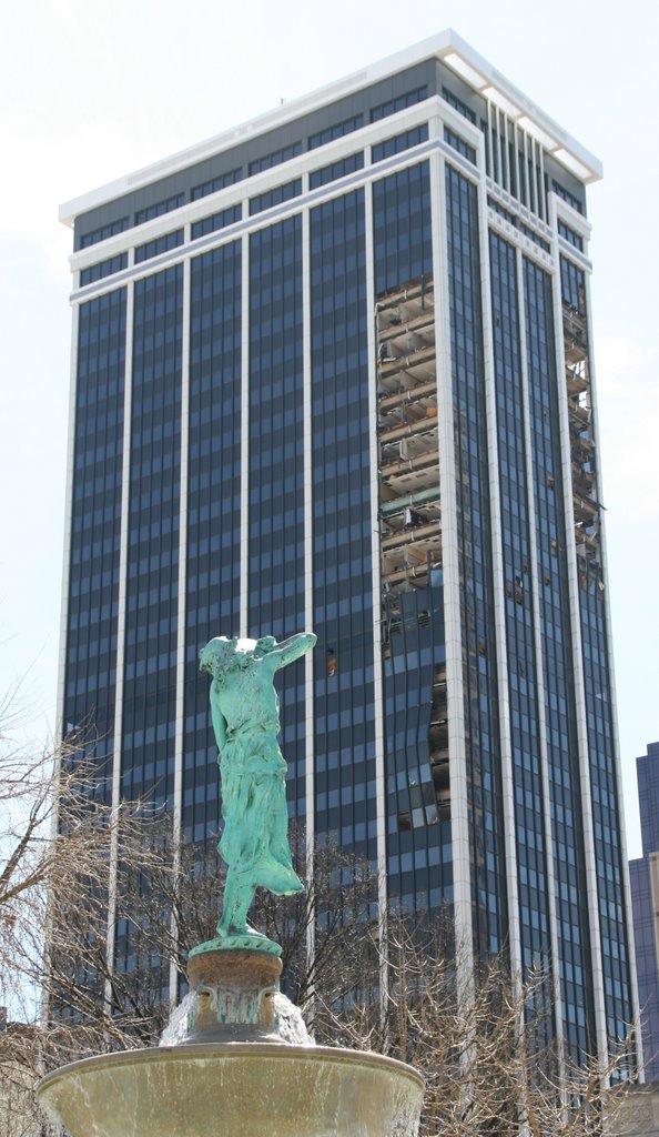
Photo taken from the northwest. You can see daylight through the southwest corner of the building. Also notice the buckled windows lower on the north side of the building (to the right of the statute's waist).
After the crew chief, tow pilot and instructor decided to call off flying on Sunday, the weather made sure nobody second-guessed them. The storm system that moved through later that day and night caused massive damage, including what you see in the above photo.
Here's what the National Weather Service is saying today:
“The storm that impacted central Indiana Sunday night was a derecho.” said John Ogren, Meteorologist in Charge of the National Weather Service in Indianapolis. A derecho is a widespread and unusually fast-moving thunderstorm complex producing damaging straight-line winds over hundreds of miles. They can also produce small tornadoes within the high wind areas. “The difficulty in surveying damage after a derecho is that often times the tornado damage is masked by the larger area of high wind damage.”Several tornados hit different parts of Indiana (and other states). Downtown Indianapolis was not hit by a tornado, but by winds of 100 MPH or more.
No comments:
Post a Comment